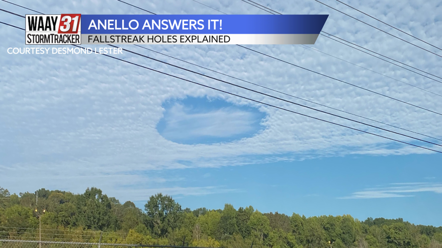

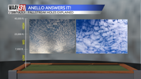


This week in Anello Answers It, we have a question from our viewer Desmond Lester. Desmond sent in this photo, taken in Huntsville, and asked what exactly is happening in this image and what lead to it?

Great question, Desmond! This picture is showing a Fallstreak Hole.

It all has to start in the atmosphere with either altocumulus or cirrocumulus clouds. Both of those are your puffy white cumulus clouds but at higher elevations than normal.

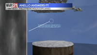
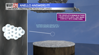
Because these clouds are higher up in the sky, they contain supercooled water droplets. Supercooled water is just water droplets that are present in an atmosphere below 32 degrees Fahrenheit. Normally, that would lead to these water droplets freezing into ice pellets but supercooled water remains in its liquid state.

That is, until it makes contact with something. Supercooled water turns to an instantaneous frozen glaze as soon as it impacts another object.
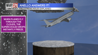
In the case of fallstreak holes, that "other object" is usually a plane. The plan itself will force the supercooled water droplets to freeze and it will also bring ice with it on its wings etc.
That is why is creates that almost "hole-punch" effect in the cloud layer.
Got a weather question you want answered? Email ganello@waaytv.com!
Find more episodes of "Anello Answers It!" here.